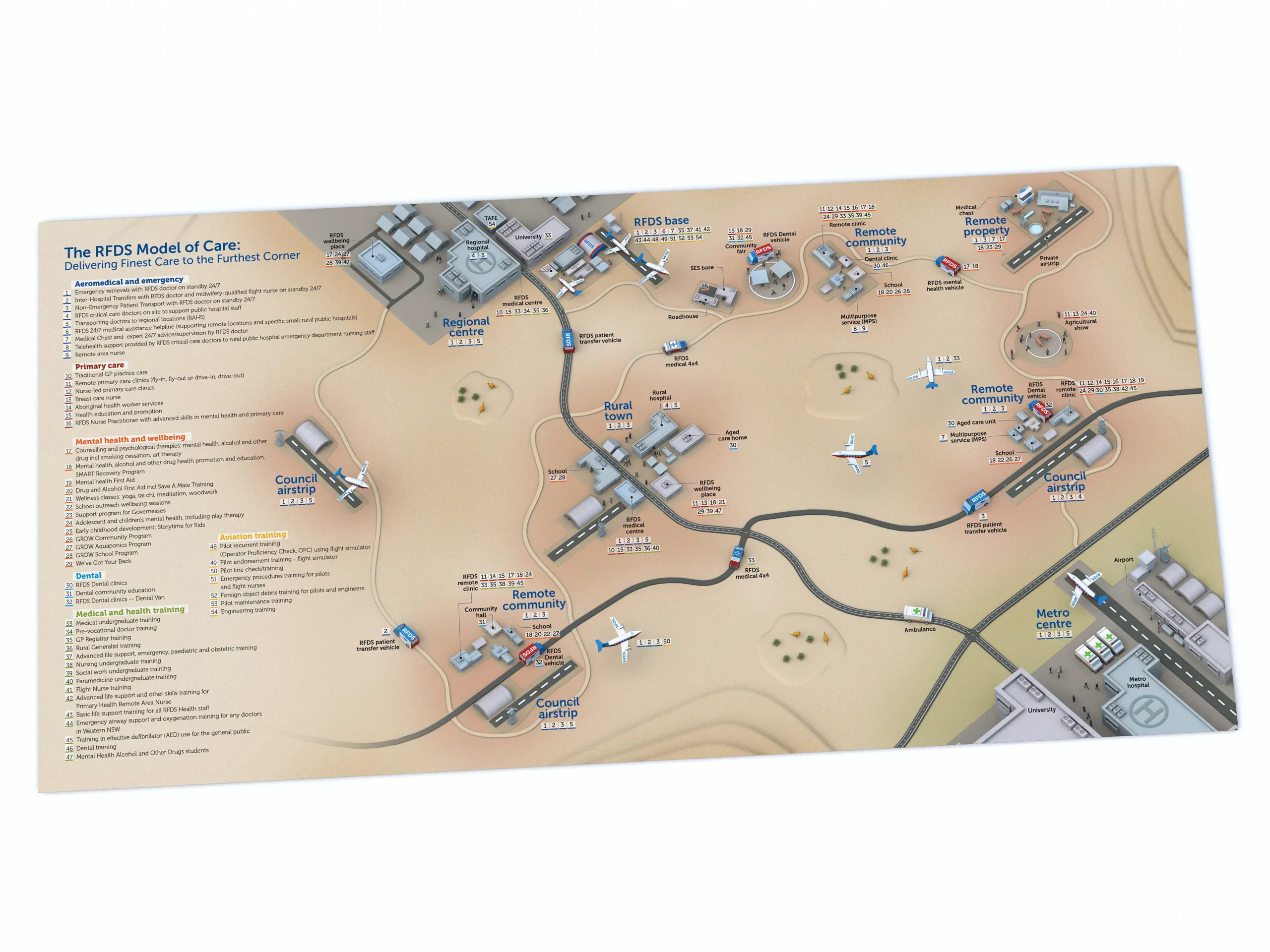
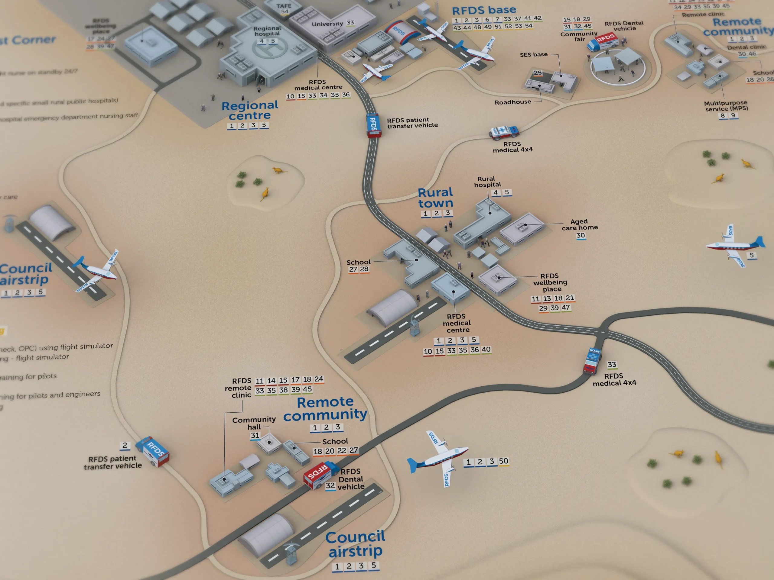
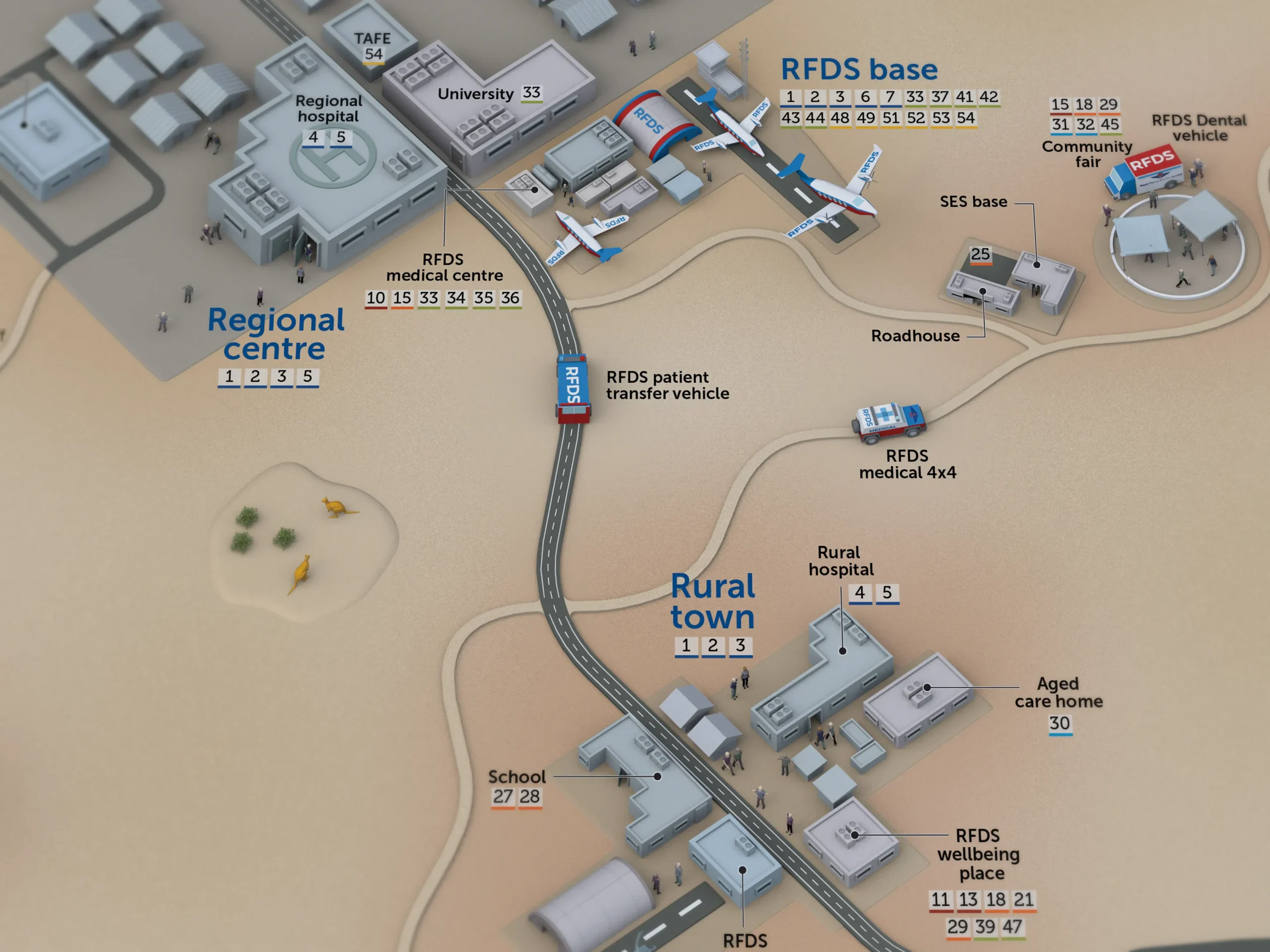
I created this illustrated healthcare map for the Royal Flying Doctor Service (South Eastern Section) as part of its Model of Care document, developed to support the case for vital government funding. Bringing communities, healthcare settings and transport connections into one landscape, the illustration helps decision-makers understand the scope of RFDS services across rural and remote NSW. From community-based care to emergency retrievals, it presents a complex healthcare network in an accessible visual overview. View the RFDS Model of Care publication and project context on the Royal Flying Doctor Service website.
My process
The illustration brings together a broad landscape view and detailed scenes of healthcare in action. My focus was on making the overall service easy to understand while giving readers smaller stories to explore throughout the artwork. Buildings, vehicles, people and landscape features establish the different care settings, with a consistent visual style connecting them across the map.
I create custom illustrated maps and visual overviews that help organisations explain their services, locations and operations. Whether you need to show how a service connects communities or bring a complex system into one clear picture, send me your brief or reference material. I’ll help you work out the best approach, timeframe and cost.